REVIEW · QUEENSTOWN
20 minute Queenstown Scenic Flight
Book on Viator →Operated by Air Milford · Bookable on Viator
Queenstown looks good from the road, but from the sky it turns into a real map of the place. I love the live pilot commentary and the tight 20-minute timing that lets you see a lot without eating your whole day. One thing to factor in: the flight is weather dependent, so you may need to be flexible if conditions don’t cooperate.
What makes this work well is how much ground they cover in a short hop. In a small group (max 12), you’ll fly over the Wakatipu Basin, get a full safety briefing, and watch the patchwork of lake, mountains, and towns snap into focus. You’re also not stuck figuring out airport logistics, because pickup is offered.
If you’re aiming for the absolute best photo conditions, plan for the reality of flying time and light. On the plus side, the experience is smooth for most people, but like any flight in a mountain region, you can feel some bumps, especially if weather is unsettled.
In This Review
- What you’ll really do in 20 minutes
- The lineup of aerial stops (and what to look for)
- Flying past the Remarkables Mountains
- Pinot Noir country from the air
- Over historic Arrowtown
- Coronet Peak and the oldest ski field angle
- Shotover River and Moke Lake
- Lake Wakatipu: length you can actually see
- The skyline gondola area and Bob’s Peak
- Returning for the final aerial view and landing
- Price and value: where $143.21 makes sense
- The real-world experience: smooth flights, good guidance, small groups
- Weather and comfort: the one factor you can’t control
- Getting there: Frankton pickup and a morning start
- Who this flight is best for (and who should skip it)
- Key points worth knowing before you book
- Should you book the 20 minute Queenstown Scenic Flight?
- FAQ
- How long is the Queenstown Scenic Flight?
- Where does the flight depart from, and where do you return?
- How many people are in the group?
- Is pickup available?
- Do I need to be concerned about weather?
- How far in advance should I book?
- What should I do about the flight confirmation before going?
What you’ll really do in 20 minutes
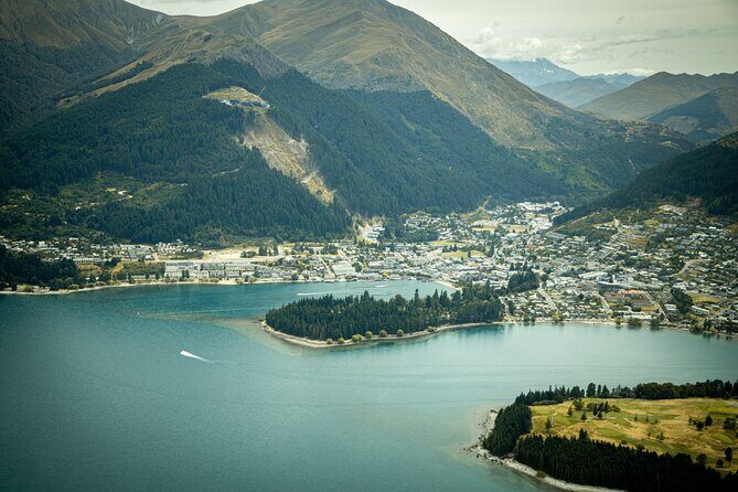
This is a short scenic flight out of Queenstown Airport, run by Air Milford. The whole experience clocks in at about 20 minutes, and it’s designed for people who want maximum views fast—whether you’re celebrating or just trying to fit Queenstown into a tight itinerary.
The vibe is practical and calm. You’ll get a proper safety briefing before you take off, then your pilot guides you with live commentary, pointing out landmarks as you go. You’ll also fly with a small group, which tends to make the experience feel less like a cattle call and more like you’re getting a guided aerial tour.
Pickup is offered from the Frankton meeting point at 3 Tex Smith Lane, Queenstown 9300, and it returns you back to the same meeting point. The start time listed is 8:30am, so you’re usually getting a head start on the day.
The lineup of aerial stops (and what to look for)
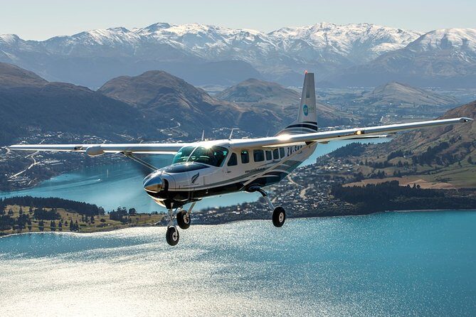
The flight route is built around the most recognizable parts of Queenstown and the wider Wakatipu Basin. Think of each stop as a quick “chapter” in the geography, from dramatic peaks to working vineyards, historic gold-rush towns, and ski terrain.
Other Queenstown tours we've reviewed in Queenstown


Flying past the Remarkables Mountains
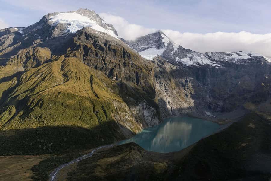
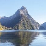
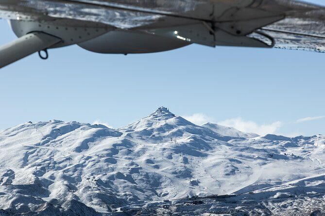
Your flight begins with takeoff from Queenstown Airport and an early look at the Remarkables Mountains. This is the part where you understand why Queenstown feels so dramatic. From above, the ridgelines read clearly—sharp slopes, the way valleys cut through, and how the mountains sit right against the lake.
What to watch: look for how the valleys feed into the Basin rather than sitting like isolated peaks. That helps you visualize why weather changes can be quick up here.
Possible drawback: early in the flight, you might still be settling into your seat and getting oriented. If you’re coming with a camera, give yourself a few seconds to get stable before you start shooting.
Pinot Noir country from the air
Next, you’ll view the Pinot Noir region from above. Queenstown’s wine country isn’t just a brand name from a brochure—it’s a patchwork of slopes and plantings that looks logical from the sky.
Why this matters: wineries and vineyards can feel abstract when you’re driving. Aerial views make it easier to see where the land is and how it rises toward the mountains.
What to watch: scan for the neat, repeating patterns that vineyards create on the hillside and the way they wrap around flatter areas near the water.
Over historic Arrowtown
Then you’ll fly over Arrowtown, the town founded after gold discovery. From the air, it’s easier to see the small scale of the settlement and how it sits with open spaces around it.
Why it’s special here: getting above Arrowtown adds context. You’re no longer just looking at streets—you’re seeing how a historic town fits into the basin’s shape.
What to watch: the edge between built areas and open land. It gives you a sense of how much the surrounding geography guided where people settled.
Coronet Peak and the oldest ski field angle
You’ll also pass by Coronet Peak, including the detail that it’s New Zealand’s oldest ski field. Even if you’re not there to ski, it’s a compelling viewpoint because you can see the ski terrain as a set of routes on the mountain.
What this gives you: a real sense of how close the town and lake are to serious slopes. The distance looks shorter from above, and that helps explain how Queenstown became a winter sports hub.
What to watch: look for how the open runs and developed ski areas sit compared with the steeper, less disturbed sections of the mountain.


Shotover River and Moke Lake
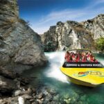
The flight then goes over the Shotover River, and you’ll see Moke Lake, described as a quieter spot tucked behind the mountains. This stretch is often the “aha” moment for many people: rivers look lively from the ground, but from above they show their shape—bends, channels, and how they carve through terrain.
Why this section works: it’s the contrast to the towns and ski slopes. You’re watching water systems and valley shapes, which helps you understand why the basin looks the way it does.
What to watch: the river’s curves and the calmer silhouette of the lake tucked into the surrounding terrain.
Lake Wakatipu: length you can actually see
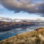
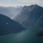
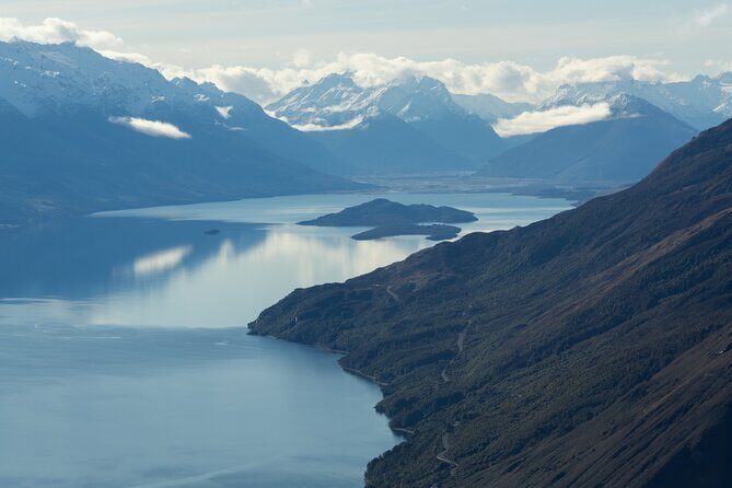
You’ll fly over Lake Wakatipu, noted as New Zealand’s longest lake at 80 kilometres. The key value here isn’t just the number—it’s seeing how the lake stretches and bends through the basin.
Why it’s worth doing from the air: from land, you tend to see only a portion. From above, the lake reads like a continuous feature, not a scenic stop.
What to watch: the lake’s long “meandering” shape and where it narrows or widens as mountains influence the shoreline.
The skyline gondola area and Bob’s Peak
You’ll pass the iconic skyline gondola and climb up toward Bob’s Peak from downtown Queenstown. This part is great if you like a direct view of the places you’ll recognize on the ground.
Why it’s practical: it helps you match what you saw in the town to what you’ll see later from viewpoints. You get the “mental map” effect fast.
What to watch: the way the gondola line connects the downtown area to higher ground, and the shape of the ridges around Bob’s Peak.
Returning for the final aerial view and landing
At the end, you take in aerial views of Queenstown and then come back into land at Queenstown Airport. This closing stretch often feels like a revisit—your earlier landmarks click into place because you’ve now seen multiple angles.
Tip: use the last moments to check your photos and reframe your shots. Even if you missed a section earlier, the final approach can still give clean views of the town-lake-mountain relationship.
Price and value: where $143.21 makes sense
At $143.21 per person for about 20 minutes, this isn’t a cheap thrill. It is, however, built for high value in one specific way: time efficiency.
If you’ve only got a short stay, a flight like this can do in minutes what might take hours of viewpoint hopping. It also gives you the context you can’t easily recreate by driving: the basin’s layout, distances between areas, and how the mountains press against the lake.
In real terms, I see this as a buy if:
- you want a quick overview without a full-day commitment
- you’re seeing Queenstown for the first time and want a big picture view fast
- you’re celebrating and want something memorable, without turning it into a logistical project
If you’re staying longer and you’re happy with viewpoints, you may not feel the cost as strongly. But if your calendar is tight, this price is easier to justify.
The real-world experience: smooth flights, good guidance, small groups
This flight is capped at 12 travelers, which is the right size for an experience that’s short. You don’t get lost in a crowd, and the pilot commentary has a better chance of landing clearly.
The most praised aspects line up with what you’d hope for: professional, experienced pilots and genuinely helpful local knowledge. One pilot named Emma Penney came up in feedback for a smooth flight and informative commentary. Another pilot, Tom, was praised for professionalism even with some turbulence. That tells me the operation is used to variable mountain weather and focuses on safety while keeping the experience moving.
What I like here: the full safety briefing before takeoff. In a short flight, that matters—because once you’re airborne, you don’t want extra delays or confusion. You want to be seeing the scenery right away.
Weather and comfort: the one factor you can’t control
This activity requires good weather, and it can be canceled if conditions aren’t flyable. The practical lesson: don’t pack the rest of your day so tightly that a reschedule will derail everything.
If you’re checking in close to departure, use the timing advice you’re given on the day. One helpful tip that came up is to call about 10 minutes before to double-check that conditions still allow the flight. It’s a small step, but it can save you from arriving assuming everything will go on.
Also, the experience notes that most people can participate, but they ask you to let them know if you’re over 120 kg. If you’re in that range, contact them before you go so they can advise based on their aircraft and safety practices.
Getting there: Frankton pickup and a morning start

Meeting point is 3 Tex Smith Lane, Frankton, and the tour ends back there. Pickup is offered, which is a big help in Queenstown because parking near the airport area isn’t always fun and finding the right curb can be a hassle.
With a listed start time of 8:30am, you’re likely flying in daylight with better visibility than some later time slots. If you’re the type who likes morning plans, this works. If mornings aren’t your thing, you can still do it, but build in buffer time so you don’t feel rushed.
Who this flight is best for (and who should skip it)
This is ideal if:
- you’re short on time and want a quick overview
- you want a special-occasion experience that doesn’t run long
- you like guided sightseeing where someone explains what you’re seeing while you fly
It may not be the best fit if:
- you hate any weather uncertainty (even though you get offered another date or a refund if canceled due to poor weather)
- you’re already planning multiple long outdoor viewpoint hikes and don’t need the aerial context
If you’re traveling with a family, it can also be a win because the total time commitment is small—just be mindful that short flights still require you to get to the meeting point promptly.
Key points worth knowing before you book
- A 20-minute aerial overview that’s built for short schedules
- Live pilot commentary that turns geography into something you can actually understand
- Small group size (max 12) for a calmer experience and better attention
- A route that mixes peaks, towns, vineyards, and ski terrain so you get context fast
- Weather dependent so keep a little flexibility in your day
Should you book the 20 minute Queenstown Scenic Flight?
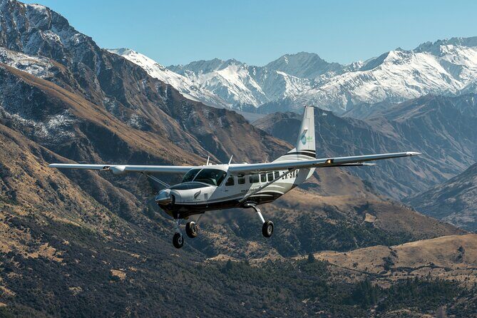
If you’re the kind of person who wants to get your bearings quickly, I’d book it. Queenstown is one of those places where the real magic is how the mountains and lake squeeze together, and a short flight is one of the fastest ways to make that click.
I’d especially book it if your trip is tight and you don’t want to spend your limited time bouncing between viewpoints. This is also a solid pick for a celebration, because it feels special without turning into a whole production.
Just go in knowing the weather factor is real. If you can accept that you might need to adjust plans, this is a high-value use of time in Queenstown.
FAQ
How long is the Queenstown Scenic Flight?
The flight is listed as about 20 minutes.
Where does the flight depart from, and where do you return?
It departs from Queenstown Airport and the activity ends back at the meeting point in Frankton (3 Tex Smith Lane).
How many people are in the group?
The experience has a maximum of 12 travelers.
Is pickup available?
Yes, pickup is offered. The tour also ends back at the meeting point.
Do I need to be concerned about weather?
Yes. The flight requires good weather, and if it’s canceled due to poor weather, you’ll be offered a different date or a full refund.
How far in advance should I book?
On average, it’s booked about 32 days in advance.
What should I do about the flight confirmation before going?
You receive confirmation within 48 hours of booking, subject to availability. If you’re concerned on the day, there’s advice to call about 10 minutes before to double-check flyable conditions.